The best way to see this park is to pay for a boat trip. On July 4th, I got to watch fireworks over Lake Superior from Munising, Michigan after having a dinner of a pasties (pronounced pah-stees) – kind of like a turnover, one was chicken and for dessert I had a blackberry one. Both were delicious.
Pictured Rocks National Lakeshore
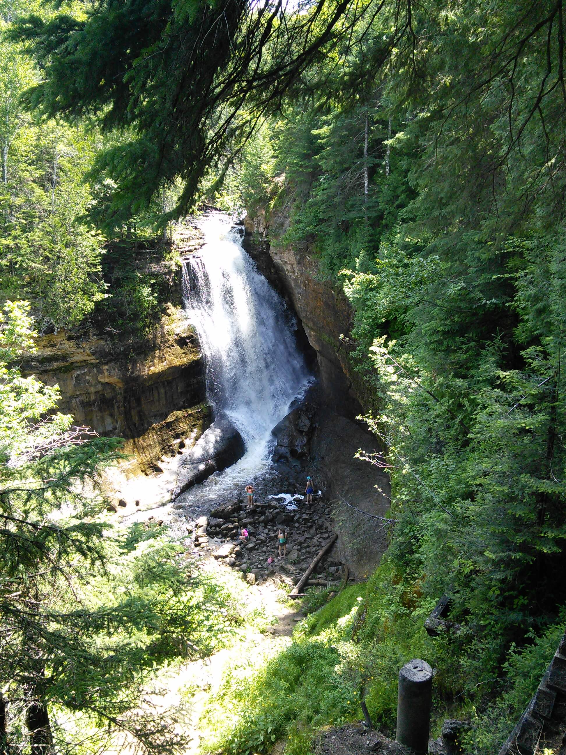
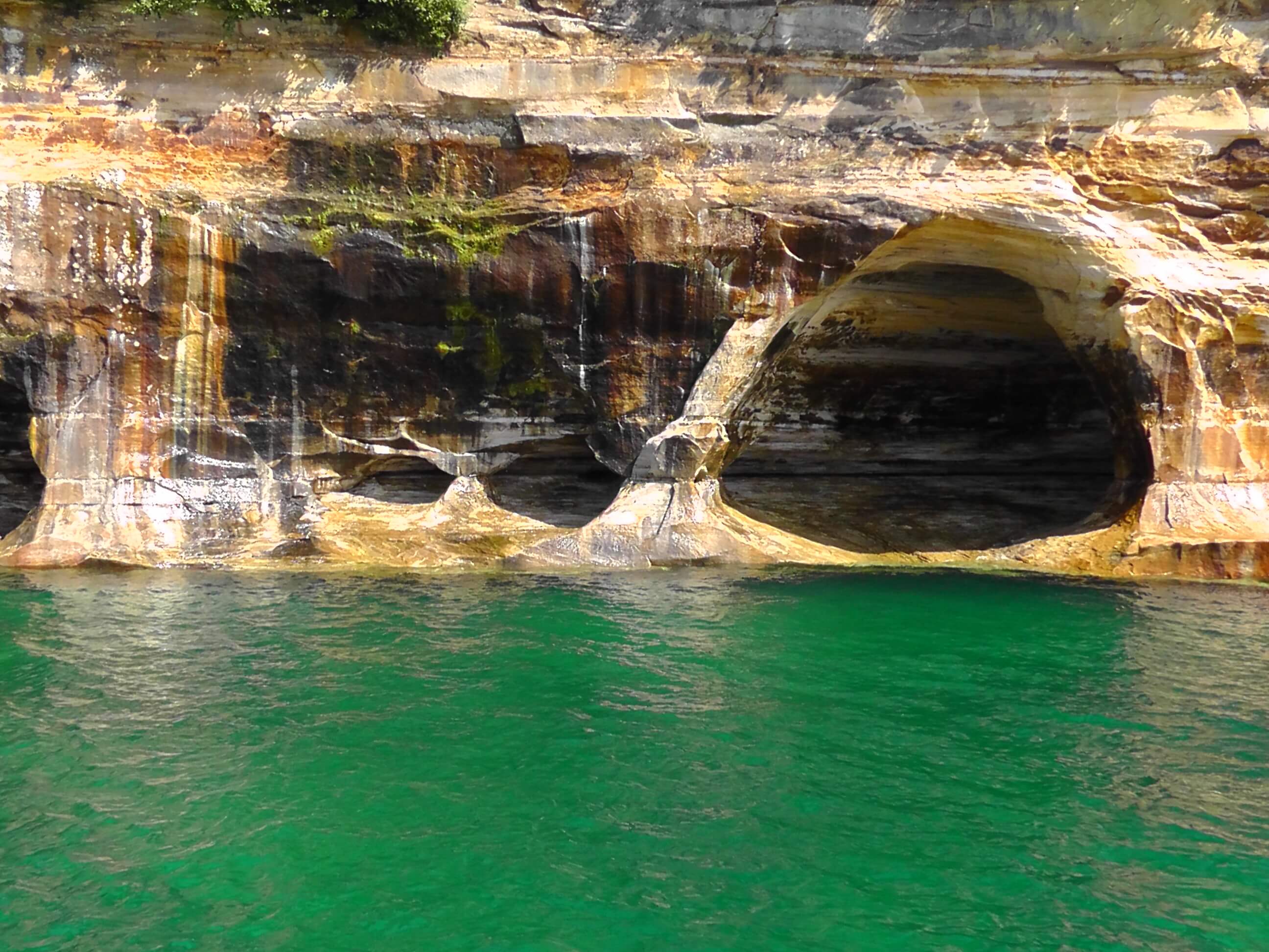
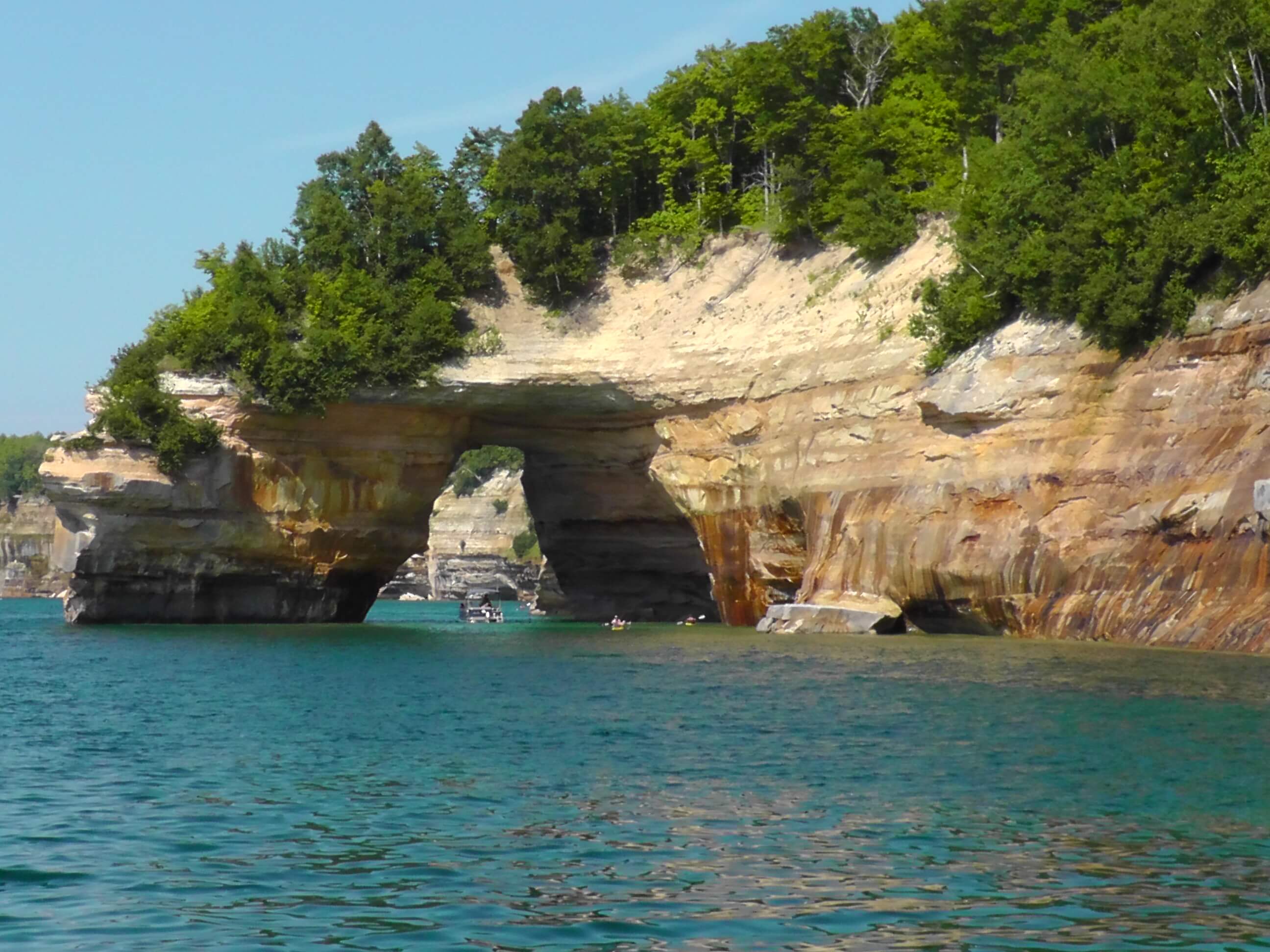
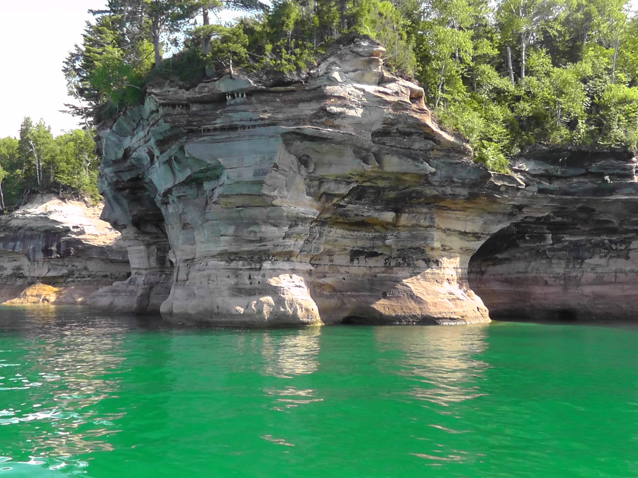
Pictured Rocks National Lakeshore is a U.S. National Lakeshore on the shore of Lake Superior in the Upper Peninsula of Michigan, United States. It extends for 42 miles (67 km) along the shore and covers 73,236 acres (114 sq mi; 296 km2). The park offers spectacular scenery of the hilly shoreline between Munising, Michigan and Grand Marais, Michigan, with various rock formations like natural archways, waterfalls, and sand dunes.
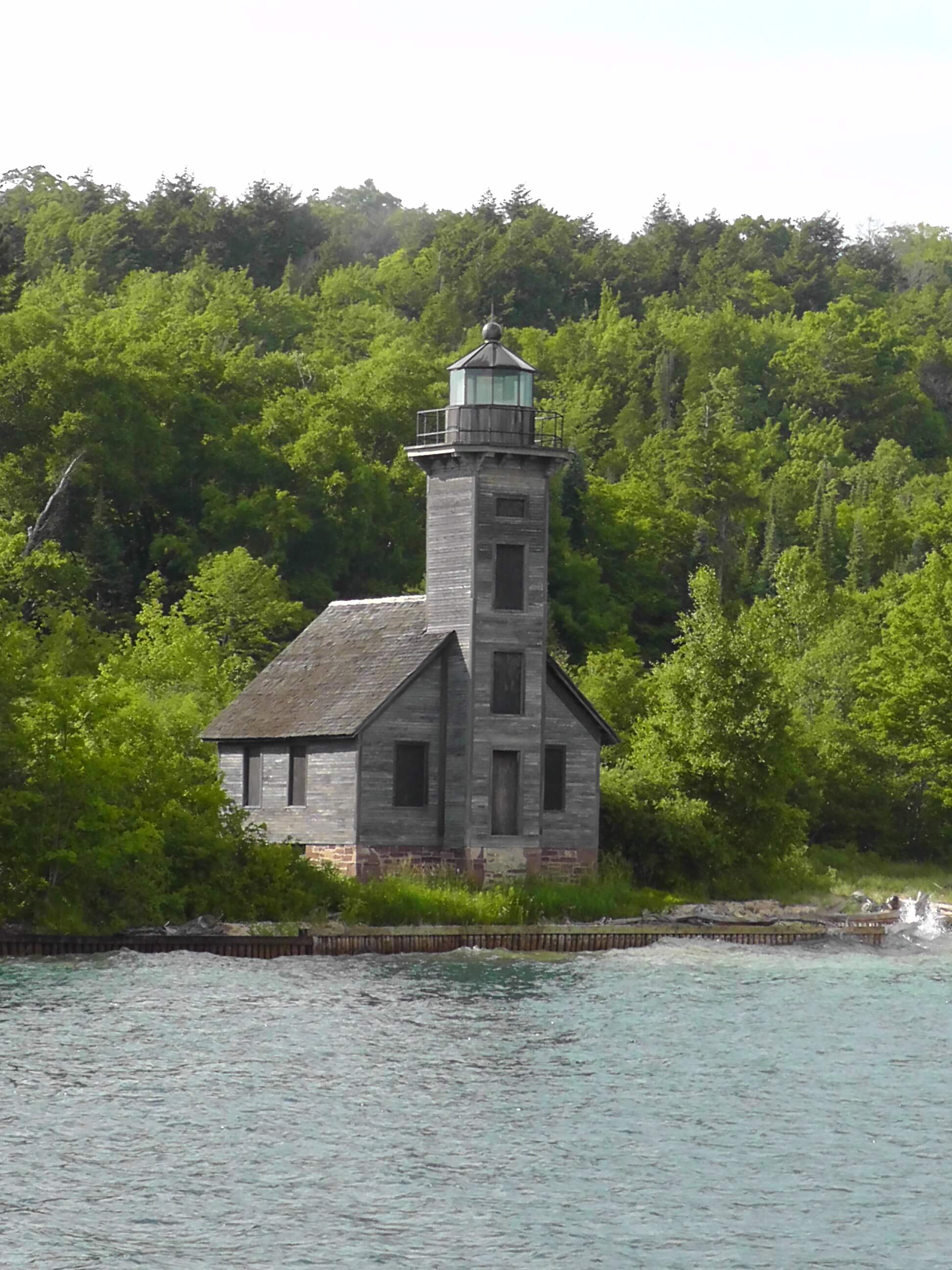
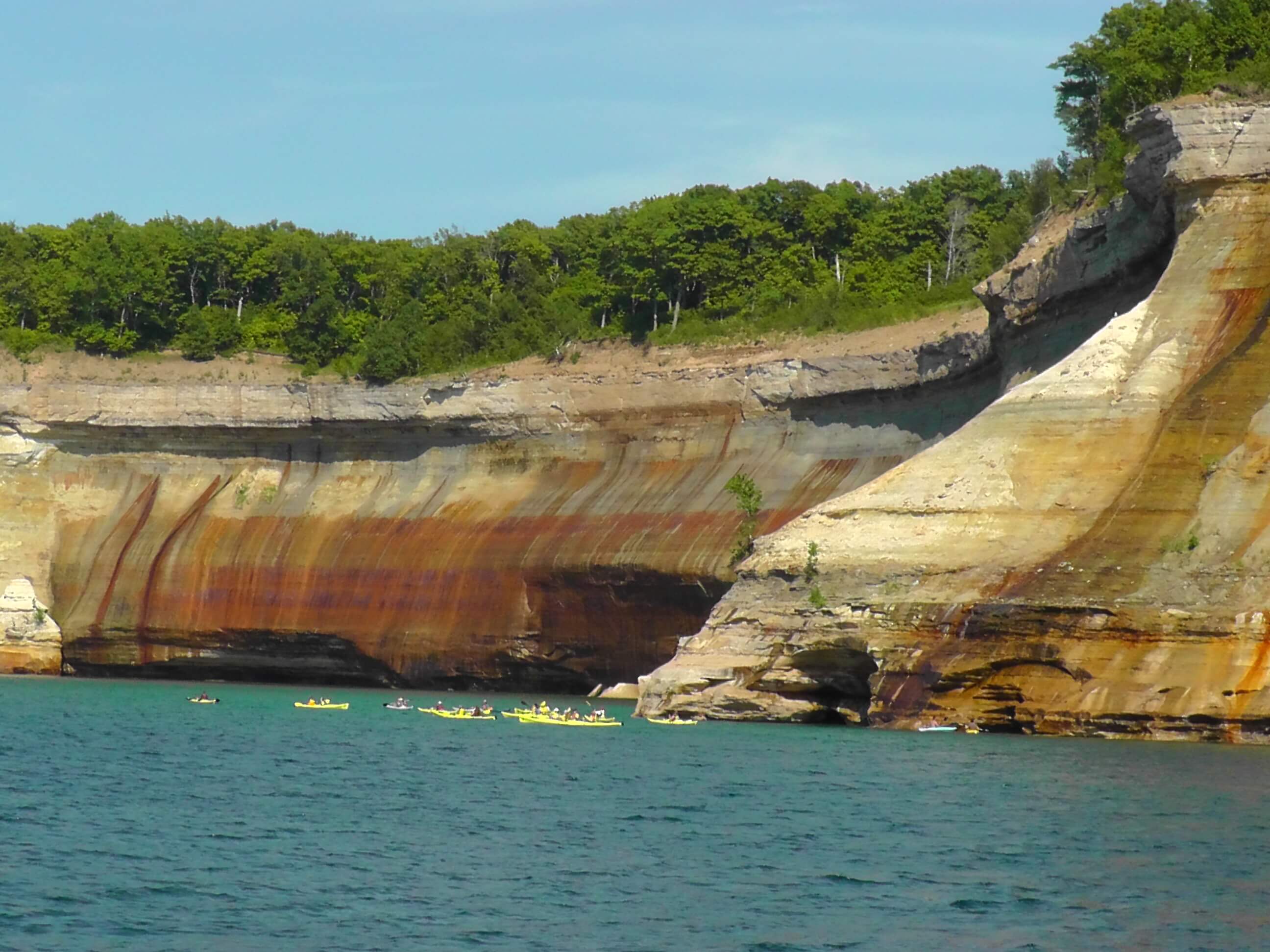
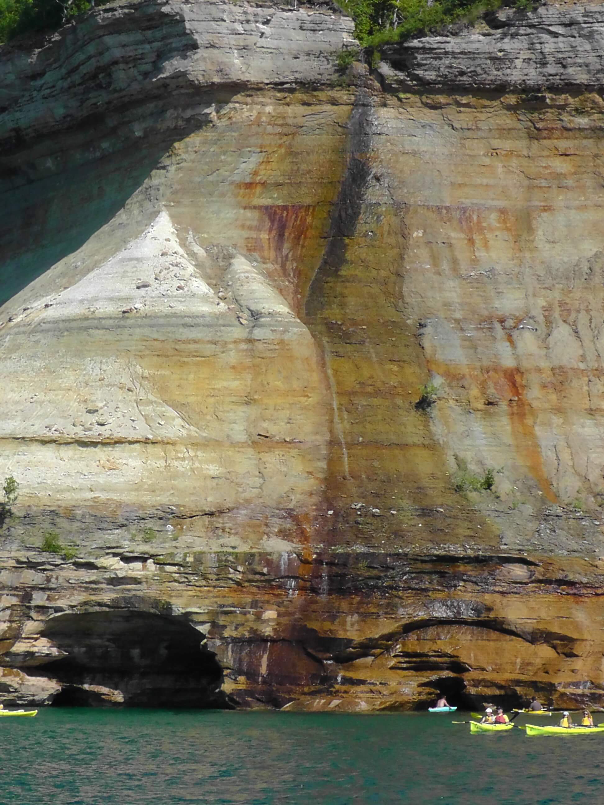
Pictured Rocks derives its name from the 15 miles (24 km) of colorful sandstone cliffs northeast of Munising. The cliffs are up to 200 feet (60 m) above lake level. They have been naturally sculptured into shallow caves, arches, formations that resemble castle turrets, and human profiles, among others. Near Munising visitors also can view Grand Island, most of which is included in the Grand Island National Recreation Area and is preserved separately.
Umbilical Tree