Bonneville Flood
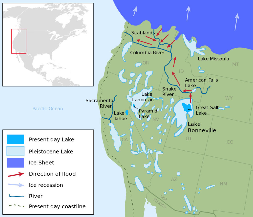
About 14,500 years ago, pluvial Lake Bonneville in northern Utah reached its highest water level since its formation. The lake occupied the present-day basin of the Great Salt Lake, except it was far larger, covering about 32,000 square miles. As it rose the lake level caused seepage at, then breached, the ancient level of Red Rock Pass, a mountain pass at the headwaters of the Portneuf River, a tributary of the Snake River above present-day American Falls Reservoir. Ancient Red Rock Pass was the site of two alluvial fans descending from opposite sides of the notch, forming a natural dam. When the dam collapsed, it released a 410-foot high flood crest down the Portneuf River valley, also spilling into the neighboring Bear River valley. When it reached the Snake River, it eroded away a lava dam that had been at the site of the present-day American Falls, releasing a 40-mile long lake, American Falls Lake, that had formed behind the natural dam.
At the peak of the flood, approximately 33,000,000 cubic feet per second poured over the Snake River Plain at speeds of up to 70 miles per hour and deposited hundreds of square miles of sediments eroded from upstream. The flood scoured the 600-foot deep Snake River Canyon through the underlying basalt and loess soil, creating Shoshone Falls and several other waterfalls along the Snake River. It also carved and increased in size many other tributary canyons, including those of the Bruneau River and Salmon Falls Creek. The flood then entered Hells Canyon, significantly widening the gorge. Its waters eventually reached the Pacific Ocean via the Columbia River.
Return to Twin Falls